| History of the Bridgewater Roads and Train Station |
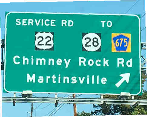 |
Today Bridgewater’s roads are well paved and complete with guard rails, street lights, and appropriate signage.
One could call these roads “modern”, but while that would be an accurate description it would also be a misleading description as “modern” hides
the fact that most of the roads in Bridgewater existed over a century and a half ago. And the same can be said of the train line that comes to Bridgewater.
For that is also modern, but its origin goes back over 180 years. |
 |
The Roads
The basic road structure in Bridgewater was formed long before the invention of the automobile. It started in the 1700s.
For a 1766 map shows that Foothill Road, Washington Valley Road, and Main Street/Old York Road were all in use.
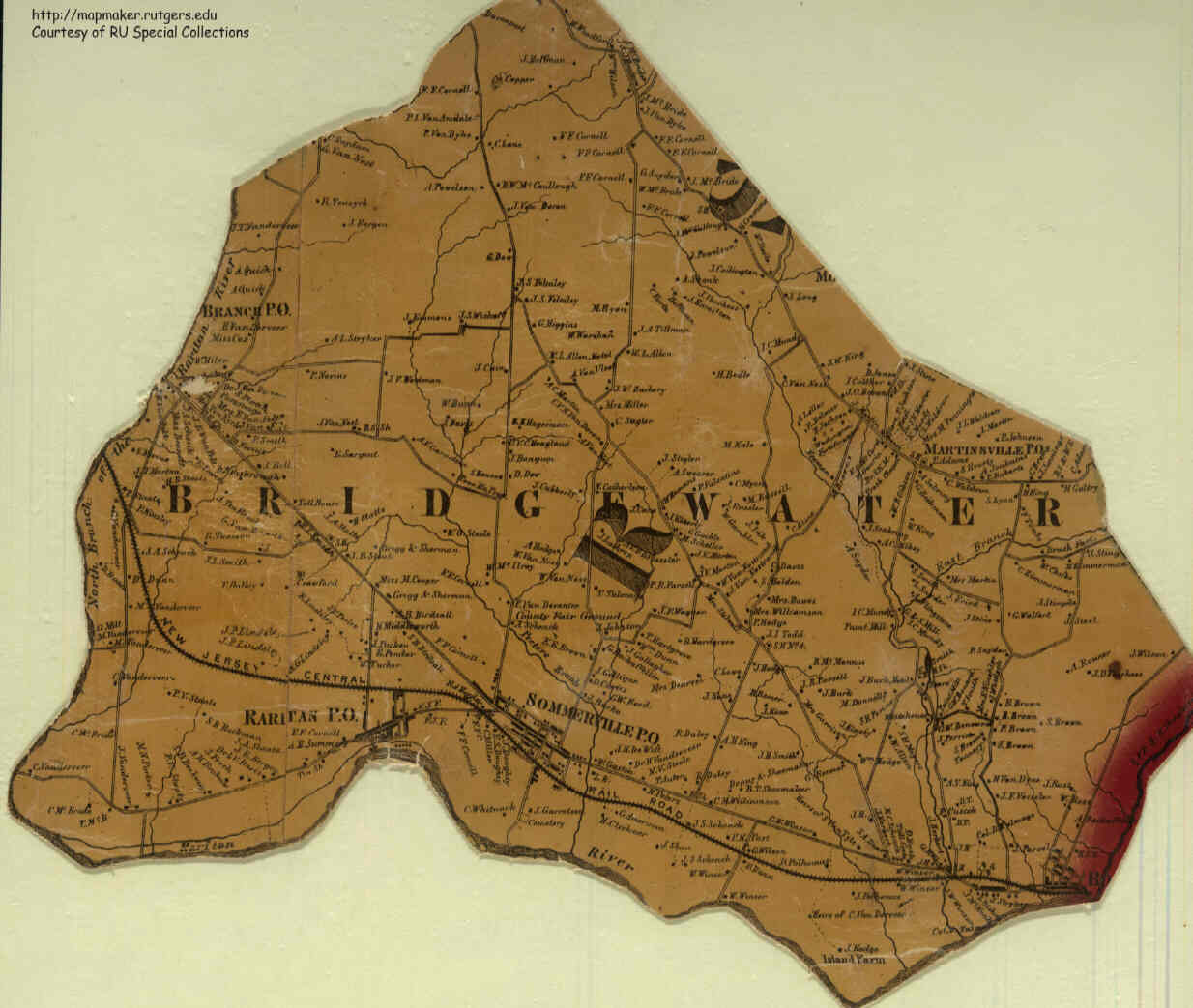
By 1860 many of the roads that we know today existed. For on an 1860 map of Bridgewater on the west side of town we see Milltown Road, Vanderveer Road,
Van Holton Road, Garretson Road, and Meadow Road. On the east side we see Adamsville Road, Finderne Avenue, Chimney Rock Road, Thompson Street and Vosseler Avenue.
All the roads are in the exact position that we know them today.
|
| Click to see full map |
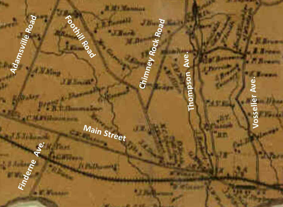 |
Over time almost everything in a town changes, but the original roads remain the same. A comparison of the old “1860 Map” to the modern online “Google Maps”
shows that 99% of the original roads are still used today. Even two small sections of roadway that in 1860 acted as connections between two main roads
appear to be used today as off-ramps.
Only one road that existed in 1860 has changed. What is today called “Old Tullo Farm Road” once went from Newmans Lane up through to Washington Valley Road,
but it now it is a dead-end ending before Washington Valley Road.
By 1880 a few more roads would appear as maps from then show a completed Union Avenue and Country Club Road.
|
A close inspection of the old map shows
the roads that we know today. |
 |
The next major building of a road in Bridgewater would not come until 1929. In the mid-1920s due to the increased use of
automobiles the east-west roads (Main Street and Union Avenue) were very slow moving. A faster route was needed. So a half mile north another
east – west road was built. That road is today known as Route 22. When it first opened it was called Route 29 and was just one lane in each direction.
Both the east and west bound lanes were on what is now the east bound side of the highway. A second lane was added around 1950.
(This year is an approximation as no written record can be found, just the recollections of some local old-timers gives us a ballpark date.)
Route 29 in its era had a path that may seem bizarre today. It started in East New Jersey and ran west into Bridgewater, but then, unlike today,
it turned South West using a portion of today’s 202/206 and continued onto what is now 202 South going to Flemington. That strange setup continued up until around 1950 when road numbers were revised.
|
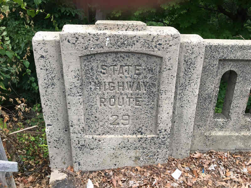 |
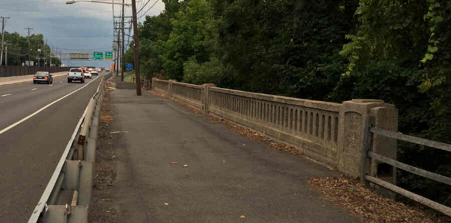
Today a link to Route 22’s past can be found on the sides of a few stone bridges on the highway.
These bridges have engraved on them the year the highway was built “1929” and the original name “Route 29”. One can drive by these stone bridges
for a lifetime without ever noticing the historical reference. |
 |
The next development in roads were the interstate highways. Until the 1950s there were no interstate highways in the U.S..
During World War II then General Dwight Eisenhower had seen the interstate type of highways that existed in Germany. He saw how wide roads with
overpasses to avoid other roads (thus no traffic lights) could move cars along at twice the speed. So when he became President he set out to build
interstate highways throughout the U.S.
The interstate era came to Bridgewater in the mid-1960s when 287 was complete.
At first, 287, which had started at the Turnpike, extended only up to Bedminster. By 1969, it had been completed up to Basking Ridge and by 1973,
it was completed up to East Hanover. |
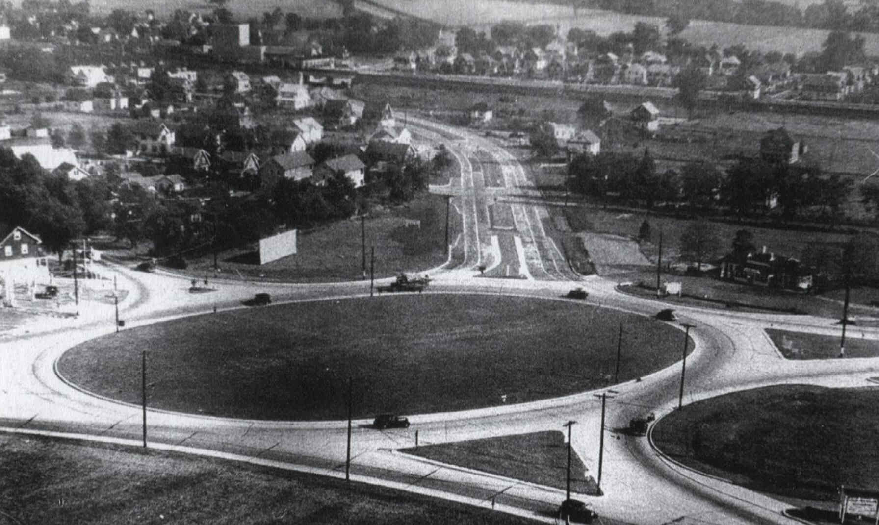 |
The dreaded Somerville Circle
While named after “Somerville” the Somerville Circle is located in Bridgewater and Raritan. When it was first constructed it was
considered an efficient modern highway design. Decades after its construction increases in traffic turned the circle into a major bottleneck.
Drivers would go miles out of their way to avoid it.
In 1994 an overpass was built over the Somerville Circle that took much traffic over top of it.
While this helped greatly with the bottleneck, driving on the circle is still a heart pounding experience. Accidents are common.
|
 |
The Railroad
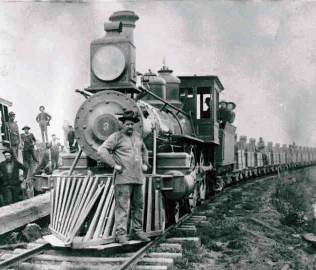
In its day the railroad revolutionized travel and life itself in the United States.
During the emergence of the railroad many routes were designed here in New Jersey.
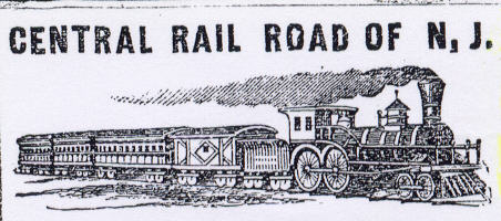
The railroad line that would come through Bridgewater was planned in 1831 when a company called
“The Elizabethtown and Somerville Railroad Company” was formed.
Like its name implies its purpose was to build the railroad line starting in Elizabethtown and move westward to Somerville.
The local population here was eager for the day that the railroad line would reach them.
Because of that the local newspapers always reported on the status of the construction.
But the logistics and construction process were all so new so progress was slow.
|
 |
After eight years, in 1839, the train tracks would reach Bound Brook.
For the next three years a stage coach route was setup going from Somerville and Bridgewater to coincide with the railroad schedule.
One could travel eastward by first taking a stage coach to Bound Brook where they could hop on the railroad. Construction continued
and in January of 1842 the train tracks had been extended through Bridgewater to a new train station at Somerville.
The railroad company had planned to extend further west, but went bankrupt. Thus Somerville would be the end of the rail line for a few years.
In 1847 a new train company was assigned to build the line further westward. By 1848 the railroad line reached Raritan. |
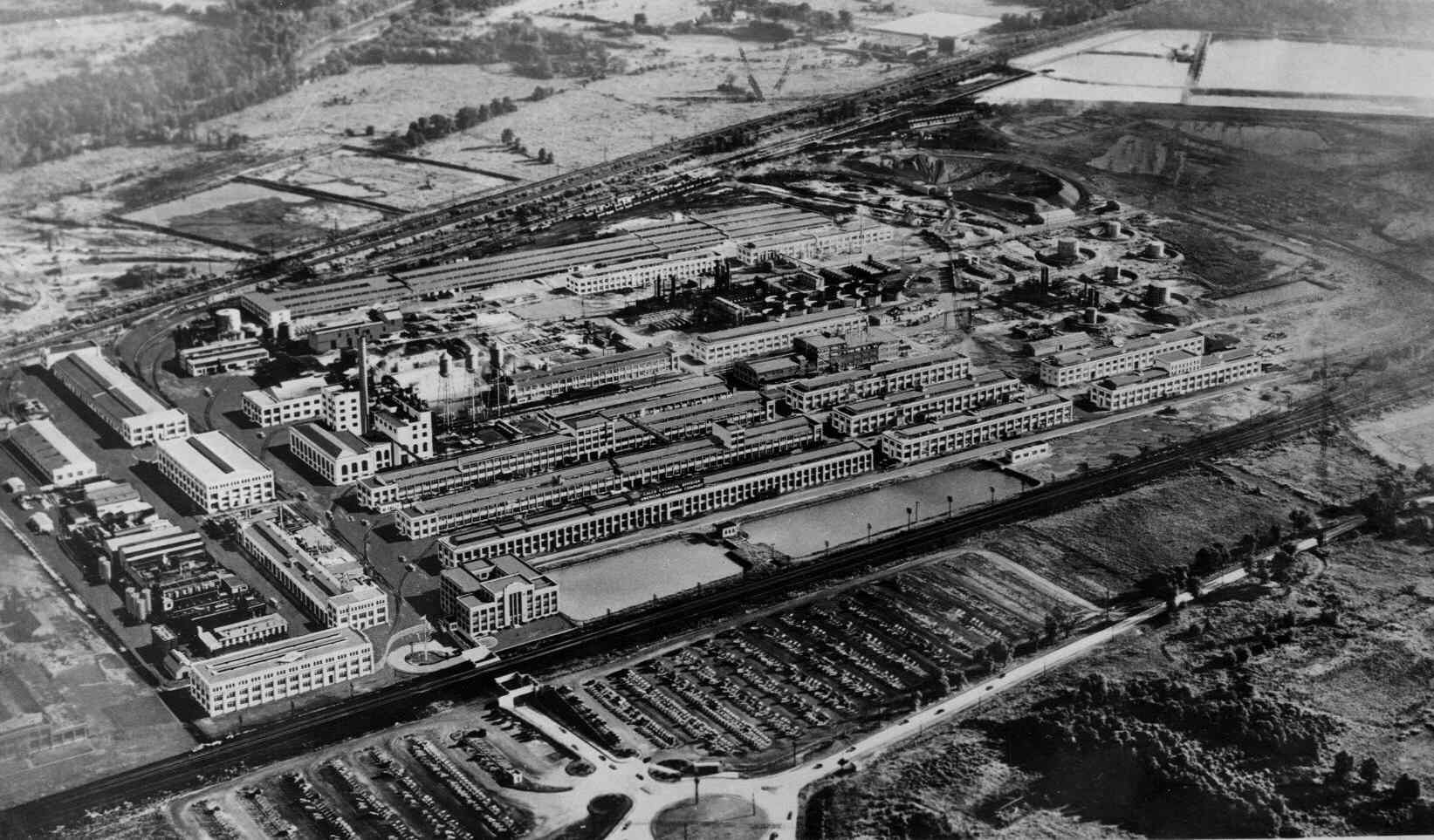 |
For several decades the train did not stop at what we know today as the Bridgewater Train Station
for that train station was not created until the Calco Chemical Company set up their complex in 1915.
That train stop was mainly for the workers and deliveries at Calco. All train stations along that line were identified
by their town’s name except the Bridgewater location which was called Calco.
Today the Somerset Patriots Baseball Stadium sits on what was the parking lot of the Calco Complex. |
The railroad first stopped in Bridgewater
when the Calco Complex was built. |


