Article for The Breeze Newspaper By Bruce Doorly

So, this author wondered what Bridgewater and Raritan were like back in 1776. Fortunately, I found a detailed map from 1766 (close enough) that shows roads, mills, property lines, houses, and other things that enable us to envision what our towns were like when our country first declared its independence.

In 1776, Raritan and Bound Brook were municipalities under Bridgewater. Somerville did not yet have its own identity as that land was considered part of Raritan.
Population
So how many people lived in Bridgewater and Raritan then? Using the data from the first census in 1790 and estimating backward for population growth, we can guess that there were around 900 people living within the borders of the Bridgewater that we know today. That is about 2% of the 2026 population.
As for Raritan, scanning the 1766 map, we find only eight houses. The average family was six people back then, so we can assume around 48 people.

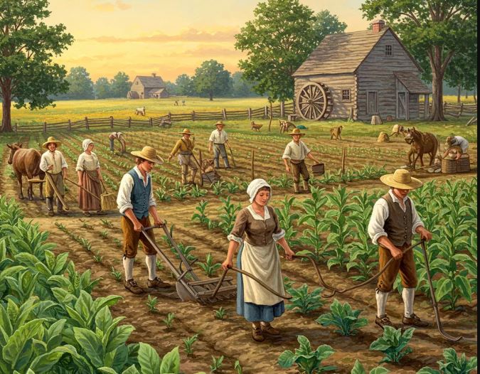
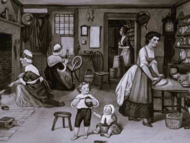
Bridgewater, like most of New Jersey’s towns, was primarily a farming community.
Shamefully slaves were often used to work the fields. As for how many slaves there were, a reliable source from 1800 says that 14 percent of Somerset County’s population were slaves. Only a small percentage of blacks were free.
It would be 1804 before New Jersey would enact a very gradual emancipation law.
Historians estimate that only about 12,000 Indians were in New Jersey when the Europeans first arrived in the 1600s.
By 1776, most of the Indians were gone from New Jersey. One reason was that there were several land purchases from the Indians in Somerset County long before 1776.
But most Indians died from diseases, such as smallpox, brought over from Europe which the Indians had no natural immunity to. Maps of New Jersey during this time show only one Indian tribe in South Jersey.
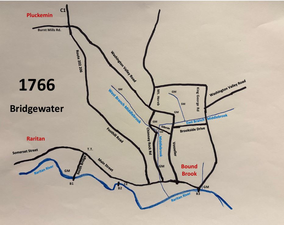
Many of the roads that we know today are found on the 1766 map. But none of these roads had the names that we know them as today. All roads were unpaved.
On the 1766 map, we see today’s Somerset Street in Raritan which leads in Main Street in Somerville and Bridgewater. This was called the Old York Road. A popular stage coach line, the Swift-Sure Stage Line, traveled over this road as it went between Philadelphia and New York.
We see today’s Washington Valley Road starting at Route 202/206 and extending southeast until Vosseller Avenue. Washington Valley Road was the population center of Bridgewater. Many houses were there with property enough for small farms.
Chimney Rock Road is present connecting Washington Valley Road with Main Street. Vosseller Avenue does the same.
Gilbride Road and Brookside Drive in today’s Martinsville are also on the 1766 map.
Washington Valley Road

The 1766 map shows two churches.
The one church is St. Paul's Lutheran Church in Pluckemin (just outside of Bridgewater) on today’s Route 202/206. It was built in 1756 and was torn down early in the 19th century when the original church was no longer safe. In 1852, the Pluckemin Presbyterian Church, that we still see today, was built in the same location.
The other church on the 1766 map is the Dutch Reformed Church which was located at today’s Finderne Avenue just north of the Raritan River. Built as early as 1725, it was later burned in 1779 in the Revolutionary War by the British when military supplies were said to be found in the church. The congregation would move to Bound Brook.
is today where St. Paul's Lutheran Church once was.
The 1766 map shows three bridges that cross over the Raritan River. Today, all three of those locations have bridges.
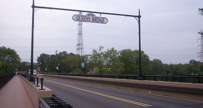
The eastern bridge (B3 on the map) connects Bound Brook to South Bound Brook. It was completed in 1731 - called the Queen’s Bridge. It was likely named after Queen Caroline, wife of King George II. Sources say the initial bridge was rebuilt in 1767. That bridge served for over a hundred years, then, in 1875, a new steel bridge was built at the site. In 1984, the current bridge was built.
A plaque on today’s bridge says that version of the bridge was built in 1934.
While a bridge is at that location today (and has been for over 100 years), an 1873 map does not show a bridge there.
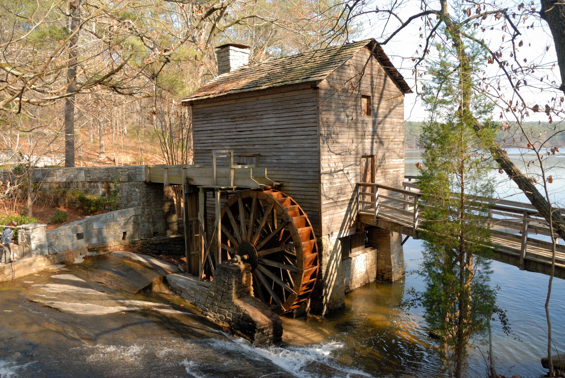
Our 1766 map shows that Bridgewater had seven grist mills and two sawmills.
Two of the grist mills were on the Raritan River. All other mills were along the various sections of the Middlebrook streams – the main stream and the east and west branches.
Grist mills were water-powered mills that were situated next to a river or stream where the current turned the water wheel, which turned heavy stones, which ground corn into cornmeal or wheat into flour for baking. Sawmills were also powered by water. Their function was to cut tree logs into lumber.

One label on the 1766 map simply says “Falls.” But this no doubt was a well-known beautiful location in the wilderness.
Flowing along the path of the Middlebrook, the Buttermilk Falls at Chimney Rock, as it came to be known, was an impressive site. Postcards from the early 1900s capture the beauty of it.
Damming up stream after 1920 reduced the water flow to just a trickle. The fact that the 1766 map makers included it speaks of how significant this place was.
Future articles in this celebratory year will highlight local houses from 1776 - and what everyday life was like in 1776.